Integrated Land Management in Alberta’s oil sands: A blueprint for cooperative care
March 17, 2026
Integrated Land Management (ILM) is a collaborative approach to resource development that “aims to balance values, benefits, risks and trade-offs when planning and managing resource extraction, land use activities, and environmental conservation and management”1. It recognizes that activities like forestry and the energy industry are interrelated; both require access and use of the same pieces of land for different purposes and maintaining ecosystems requires long-term planning and coordination. ILM looks at the big picture – coordinating industrial activities such as oil sands extraction, forestry, and infrastructure development – rather than making decisions in isolation. By focusing on shared roads, coordinated clearings, and joint timing of activities, the Government of Alberta’s ILM approach aims to reduce disturbance relative to that which would have occurred without integration.
Background
Integrated land management traces its origins to the 1970s, when the Alberta government looked at integrated resource management (IRM) as a way to manage public lands and natural resources, with public input to establish sustainable use goals in certain planning areas. The IRM approach did not impact regulatory processes, nor was it law, and therefore its use floundered over time. A lack of consistent and clear direction for operators and inconsistent updates led to IRM falling out of favour in the mid-nineties. In 1999, the Government of Alberta created Alberta’s commitment to Sustainable Resource and Environmental Management policy, aimed at resolving ongoing land-use conflicts and managing cumulative environmental effects on the land. Regional strategies were developed within the Integrated Resource Management Division of the government, with stronger policy commitments, followed by the Alberta Land Stewardship Act in 2009.
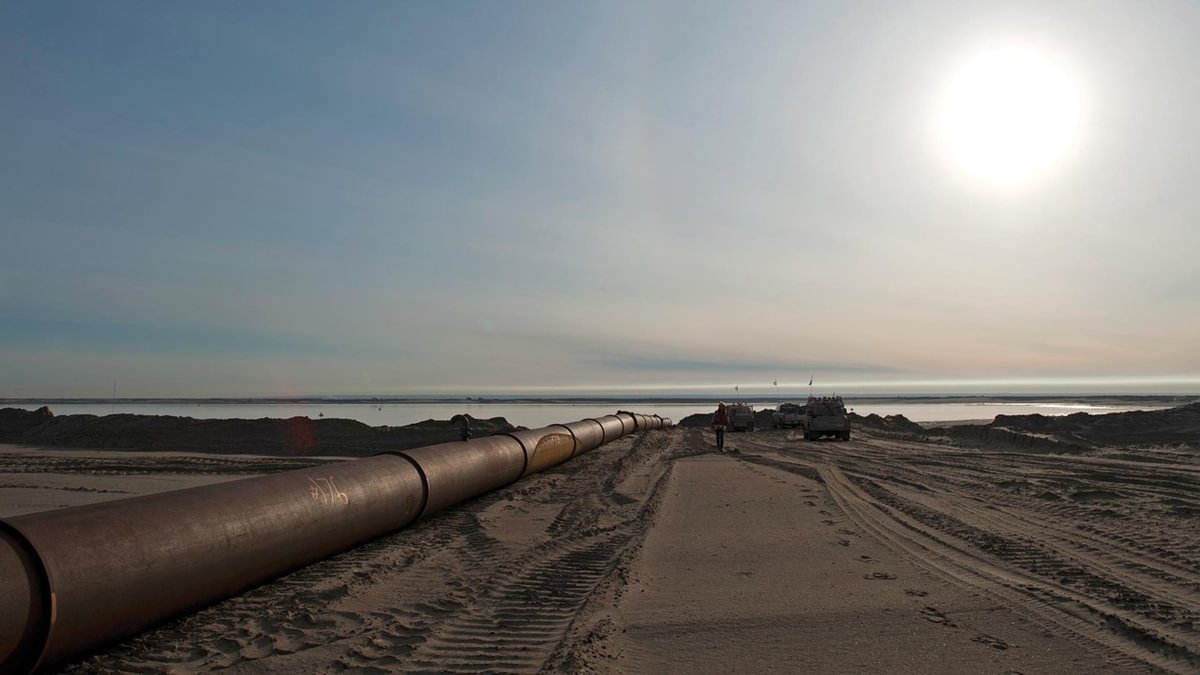
In the early 2000s, expanding networks of roads and seismic lines from oil and gas operations were increasingly fragmenting the forest, creating increased opportunities for wildlife to change movement patterns and reducing habitat connectivity. This occurred before provincial regulations mandated replanting on abandoned roads and well pads, and caused millions of cubic metres of timber to be stranded in Alberta’s northeast. Nearly half of that timber was considered marketable, and fragmentation created the risk of potential permanent loss of productive forestry.
Alberta-Pacific Forest Industries (Al-Pac) approached Gulf Canada Resources (GCR) to discuss an ILM arrangement at GCR’s multi-phase commercial scale SAGD project in the Surmont area of Alberta. The companies determined that if they worked together on an integrated land management plan (“Surmont pilot project”), they would need 50% fewer roads, which would benefit wildlife and local trappers. The project also showed potential for 34% reduction in linear disturbance and 16% reduction in total cleared area2.
Similarly, Al-Pac approached Opti Canada and Nexen in 2008 to discuss integrating activities at their Long Lake Project in the boreal forest, which was under a long-term Forest Management Agreement by Al-Pac. The Long Lake Project was located over Al-Pac’s timber harvest footprint, and the companies determined they would be able to reduce their industrial footprint and work together more cooperatively if they used a coordinated corridor and footprint development approach, ultimately building a shared road that each could access (“OPTI-Nexen project”). The agreement resulted in about 30% fewer harvested trees on one shared footprint.
Other oil sands operators and forestry companies used the Surmont pilot project and OPTI-Nexen project as models to use land efficiently and to reduce the footprint of human activities on Alberta’s landscapes.
ILM in practice
Championed by government, industry and academia, ILM focuses on two main components:
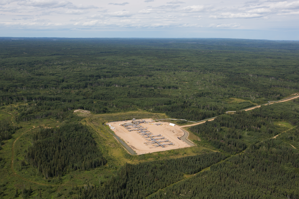
- Access sharing: Roads are shared among operators to avoid duplicating networks.
- Coordination of clearings: Clearings (e.g. cut blocks and well pads) are shared or sequenced to minimize new disturbances.
In ILM, forestry gains efficiency because the energy industry typically requires higher grade roads. For forestry, access and utilization of higher-grade roads increases efficiency for timber harvest operations.
Collaboration is key to success in ILM, and relies on long-term integrated planning, a challenging undertaking when industries have different planning horizons and separate regulatory frameworks. For example, forestry routinely plans 50-100 years out, whereas energy does not have the luxury of being able to reliably map out their resource 100 years out. As technology changes and reservoir characterization and economics change, so does the ability to develop the resource underground.
The benefits of overcoming this challenge are worthwhile. Since the Surmont pilot project in 2000, ILM has become a common practice, with many examples of successful ILM projects on record. The practice has resulted in reduced costs for both the forestry and oil sands industries sharing roads, while reducing loss of or damage to marketable timber. Fewer roads mean fewer disturbances to wildlife and trappers, and a greater percentage of forests being undisturbed.
While the need for ILM was spurred when the energy industry was starting to boom, the practice continues to be essential as industry works toward doubling oil production. ILM is a winning strategy for industry, the ecosystem and for communities that live and work on the land, demonstrating that industries can collaborate and realize overall footprint reductions as compared to doing it alone.
Note: Information contained in this article was gathered from a variety of sources, including Blue Ribbon Panel on Integrated Landscape Management, Towards Cooperative Stewardship, October 21, 1999; Gulf and Alberta-Pacific Forest Industries Inc., Integrated Resource Management: Surmont Pilot Study, December 2000; Sustainable Ecosystems Working Group, Cumulative Environmental Management Association, Guidelines for the Implementation of Ecosystem Management Tools in the Athabasca Oil Sands Region, November, 2002; AXYS Environmental Consulting Ltd. and Lorrnel Consultants, Ecosystem Management Tools for the Athabasca Oil Sands, February 2002.
- Government of Alberta, Integrated Land Management Overview ↩︎
- AXYS Environmental Consulting Ltd. and Lorrnel Consultants. Ecosystem Management Tools for the Athabasca Oil Sands. February 2002, p. 10. ↩︎